
Design a professional showground map — no designer needed
The ShowDayGuide map builder turns your field into an illustrated, interactive showground map — drawn by your committee in an afternoon, published straight to visitors’ phones, and edited in minutes when the layout changes.
A showground map built entirely in the map builder — every area, animal and building drawn automatically in one illustrated style.
From field to finished map in an afternoon
Search for your showground and see it on satellite view — the real field, with its real boundaries, trees and gates in front of you.
Trace the edge of your site with a few clicks. The builder turns your outline into illustrated parkland, ready for your show to be laid out on top.
Rings, marquees, trade stands, livestock pens, food areas, toilets, first aid, camping — pick from a palette of show-specific areas, then drag, resize and rotate each one until the map matches your field. The artwork draws itself as you go.
One click puts the finished map on your show's page, with a tappable pin created automatically for every area. Visitors open it from a link or QR code — no app to download.
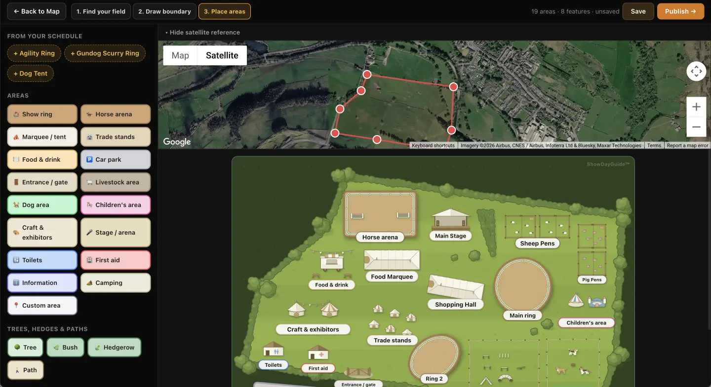
Your real field, on satellite view — draw the boundary once and the illustrated map takes its shape from it.
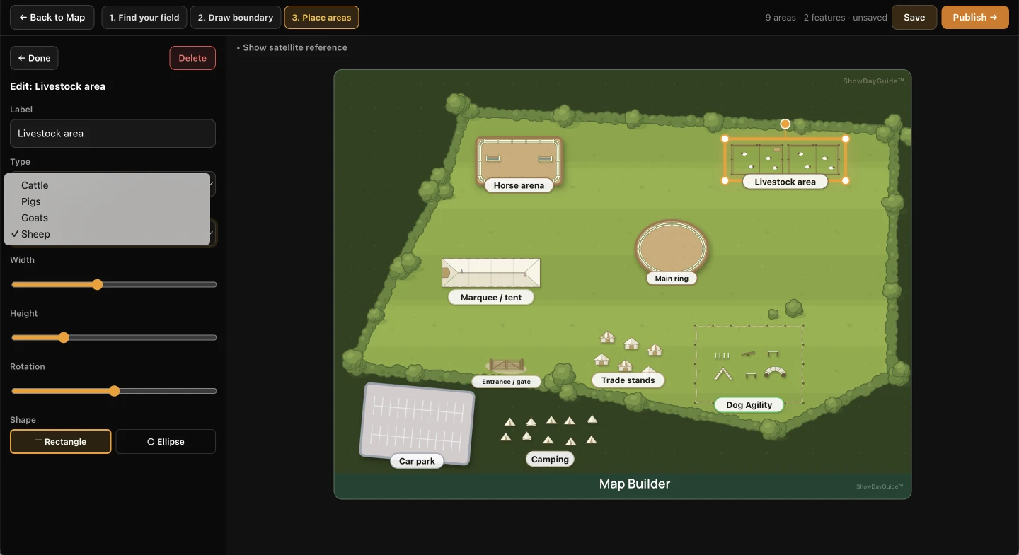
Every area knows what it is — livestock pens come in cattle, pig, goat and sheep varieties; rings, marquees and trade stands each draw their own artwork.
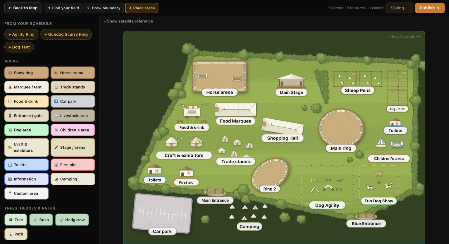
The finished map — twenty-one areas placed by hand, illustrated automatically.
The map you’d pay a designer for — included
Most shows that want a proper illustrated site map either commission one — hundreds of pounds, weeks of back-and-forth, and artwork that freezes the day it’s delivered — or make do with a hand-drawn sketch photocopied into the programme. Move a ring, add a marquee, lose a trade stand, and the commissioned version is out of date until next year’s invoice. The map builder is included in ShowDayGuide’s annual licence: no design brief, no revisions round, no annual redraw. When the layout changes, drag the area to where it now lives and the map on visitors’ phones updates in minutes.
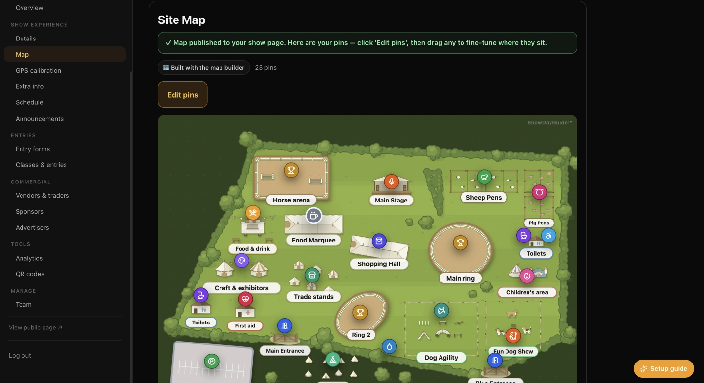
Publishing puts the map straight onto your show page — here with twenty-three interactive pins created automatically from the map’s areas, ready to fine-tune.
Upload it — the pins go on top
If your show already has a site map it’s proud of, keep it. Upload the artwork and ShowDayGuide adds the interactive layer on top — tappable pins for entrances, toilets, first aid, rings and trade stands, with the same search and offline behaviour. The map builder is there for shows that don’t have a map, or are tired of paying for one. It’s an option, not a requirement.
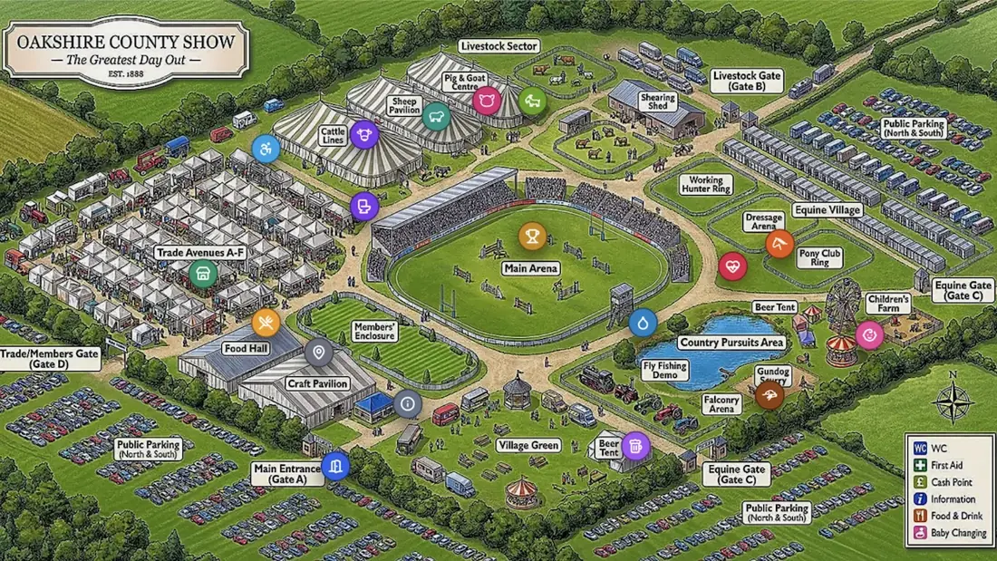
An uploaded show map with ShowDayGuide’s interactive pins added on top — the same tap, search and offline behaviour as a built map.
A map visitors actually use
Every area is a tappable pin — toilets, first aid, rings, food, entrances — with a search box for finding anything fast.
Trade stand and food pins list the vendors trading there, each linking to the vendor's own page — the map quietly sells your commercial pitches for you.
Visitors can see where they are on the showground, so "how do we get to the main ring?" answers itself.
The map keeps working when the mobile signal drops — it saves to the visitor's phone on arrival.
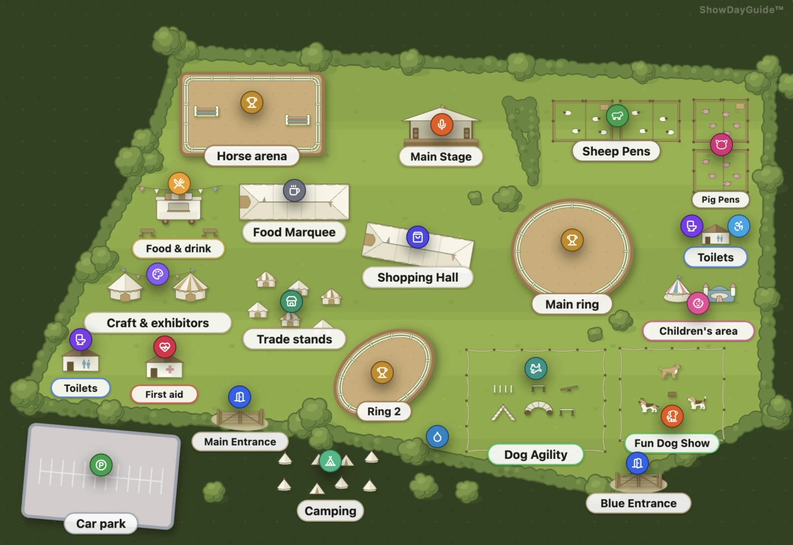
This is a live example — the same interactive map visitors get, built entirely in the map builder. Tap the trade stands pin to see how the map doubles as your show’s shop window.
An honest comparison: event-planning tools produce operational site plans for the committee, and commissioned illustrations look beautiful but freeze the day they’re delivered. The map builder makes the visitor-facing map — illustrated like a commission, editable like a plan, and interactive on every phone at the show.
See how it fits your show
The map builder is included at every level, from village fete to flagship showground:
Frequently asked questions
How much does it cost to have a showground map designed?
Commissioning an illustrated showground map from a designer typically costs a show hundreds of pounds, with a round of revisions each time the layout changes and often a fresh commission each year. With ShowDayGuide, the map builder is included in the annual licence — there is no separate design cost, and updating the map yourself takes minutes rather than a new invoice.
Do we need a graphic designer or any design skills?
No. You draw your site's boundary over satellite view and place your areas; the illustration happens automatically, in one consistent hand-drawn style. If a committee member can fill in a form, they can build the show's map.
Can we use our existing printed map instead?
Yes. If your show already has a map it loves, upload it and ShowDayGuide adds interactive, tappable pins on top — entrances, toilets, rings, trade stands and more. The map builder is there for shows that don't have a site map, or are tired of paying for one. It's an option, not a requirement.
What happens when the show layout changes?
Open the builder, drag the area to where it now lives, and republish — the change is live on visitors' phones in minutes. Nothing to re-commission, no designer to wait for, and next year's show starts from this year's map.
How do we put an interactive map on our show website?
Your show guide has its own web link, with the map built in. Link to it from your website, social media and ticket confirmations, or print its QR code on the programme and gate signs. Visitors tap and the map opens in their browser — no app to download, no account to create.
Does the map work in a field with poor signal?
Yes. The map, pins and schedule save to visitors' phones automatically, so they keep working even with no signal at all — a common situation on show day, and one of the main reasons ShowDayGuide was built the way it is.